Description
Common way to define lateral limits of airspace in aviation is not giving explicitly coordinates of points that describe the shape of the airpsace, but using distances and bearings in reference to such points as naviagation aids or coordinates.
AirspaceGeomtryBuilder plugin speeds up airspace drawning due to skipping need of caluclating intermediate points and alllows use directly values and relation that are given in airspace definition.
GitHub repository: AirspaceGeomtryBuilder
Common airspace shapes
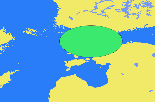
Circle
- Defiend by:
- Circle center explicitly: longitude, latitude
- Radius
- Or defiend by:
- Circle center implicitly as:
- Refernce point coordinates: longitude, latitude
- Bearing from reference point
- Distance from reference point
- Circle radius
- Example definition:
Circle of radius 1.25NM centred around coordinate 112156N 0764548E.
Circle of radius 1.25NM centred around point defined by bearing 25 degrees 10 NM from point 110000N 0763000E.
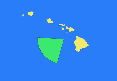
Circle sector
- An area bounded by two radii and the arc of a circle.
- Defiend by:
- Circle center: longitude, latitude
- Radius
- From bearing, to bearing
- Example definition:
A Sector of circle of radius 1.25NM centred around coordinate 112156N 0764548E between clockwise bearings 060 to 170 degrees.
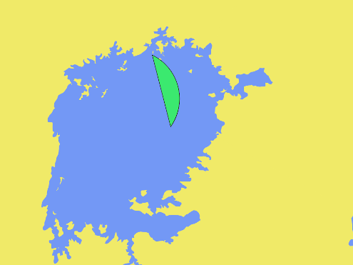
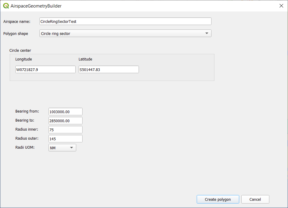
Circle segment
- An area bounded by a chord of a circle and the arc of the circle.
- Defiend by:
- Circle center: longitude, latitude
- Radius
- From bearing, to bearing
- Example definition:
Start at the point defined by bearing 70 degrees and 10 NM from point 500000N 0200000E, then along clockwise arc with radius 10 NM from point 500000N 0200000E to point defined bearing 145 degrees and 10 NM from point 500000N 0200000E, then the strait line to the start point.
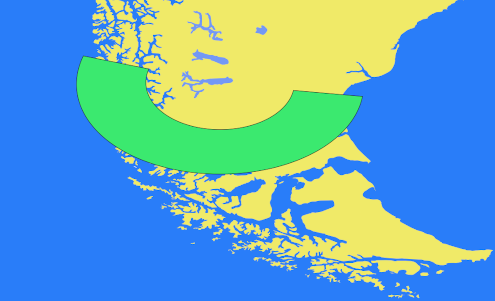
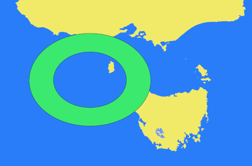
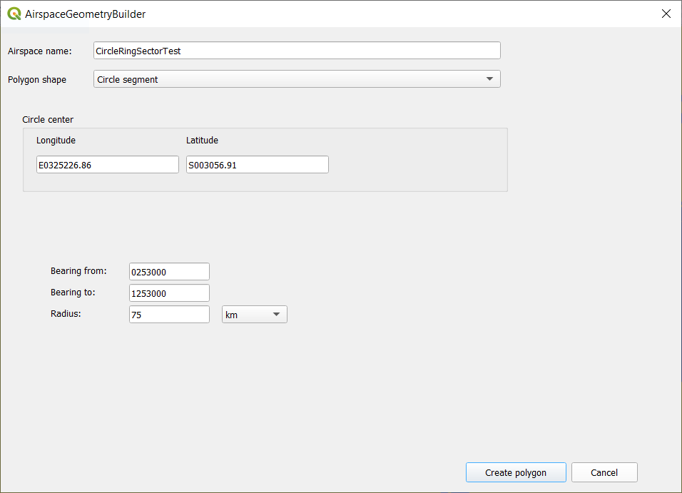
Circle ring sector
- The area bounded by two radii and two arcs of circle with the same center but different radii.
- Defiend by:
- Circle center: longitude, latitude
- Inner radius, outer radius
- From bearing, to bearing
- Example definition:
Start at the point defined by bearing 70 degrees and 10 NM from point 500000N 0200000E, then along clockwise arc with radius 10 NM from point 500000N 0200000E to point defined bearing 145 degrees and 10 NM from point 500000N 0200000E, then the strait line to the point defined by 145 degrees and 5 NM from point 500000N 0200000E, then along counter-clockwise arc with radius 15 NM from point 500000N 0200000E to the point defined by bearing 70 degrees and 5 NM from point 500000N 0200000E, then strait line to the start point.
Creating airspaces
Circle
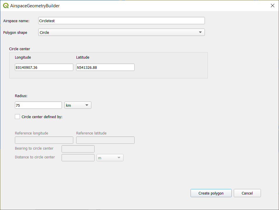
Input data:
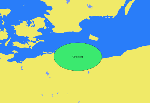
Output:
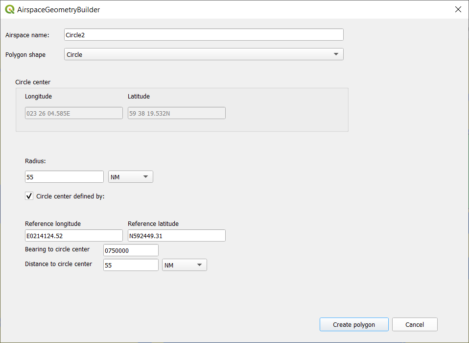
Input data:
Circle sector
Input data:
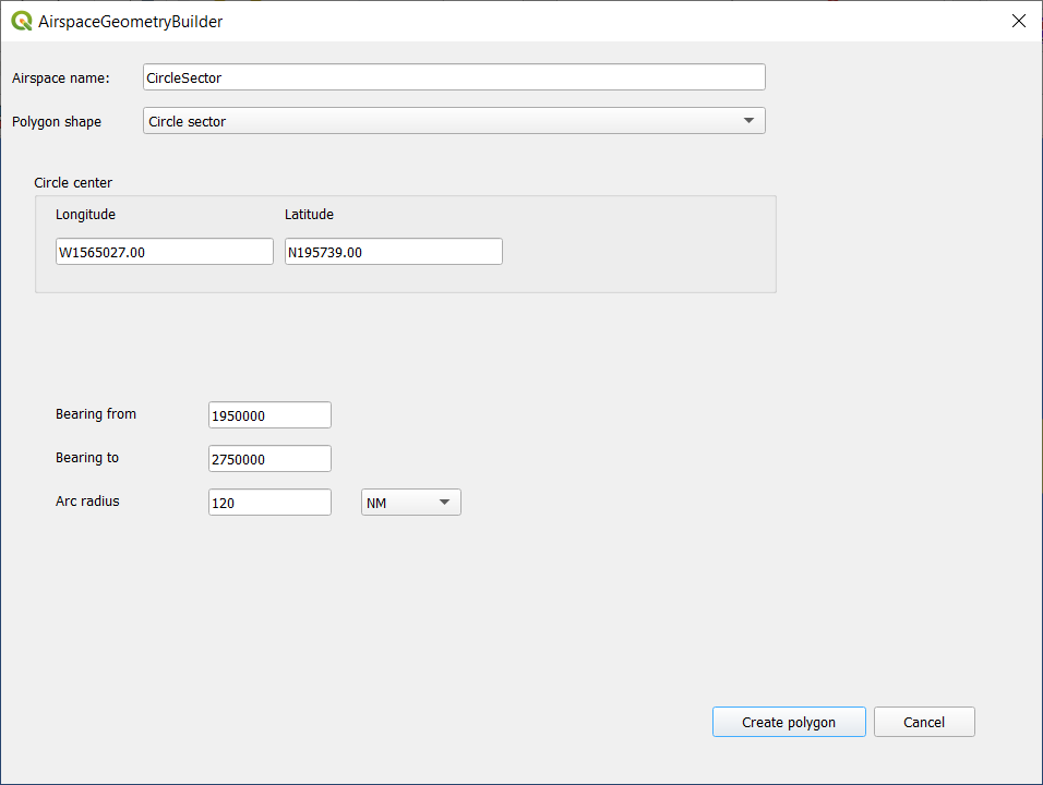
Output:
Circle ring
Input data:
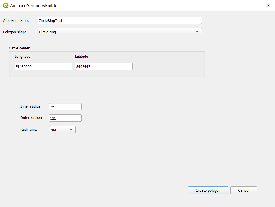
Output:
Circle segment
Input data:
Output:
Circle ring sector
Input data:
Output: