Description
ObstacleFromCSV plugin allows user to create shapfiles with predefined attributes based on data stored in CSV file. In case there is no information for such attributes as country name, obstacle type and vertical unit there is option to assign those values explicitly via plugin and entered values will be assign for all imported data.
GitHub repository: ObstacleFromCSV
Output format
Imported data is saved to shapefile with following fields:
| Field name | Type | Length | Mandatory |
|---|---|---|---|
| ctry_name | string | 150 | Y |
| obst_ident | string | 50 | Y |
| obst_name | string | 100 | N |
| obst_type | string | 30 | Y |
| lon_src | string | 30 | Y |
| lat_src | string | 30 | Y |
| agl | real | - | Y |
| amsl | real | - | N |
| vert_uom | string | 2 | Y |
Usage
Usually CSV input data file contains all information that will be storied in output file.
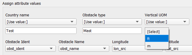
In some cases input file might not have mandatory data such data as: country name, obstacle type, or vertical unit of measure (UOM).
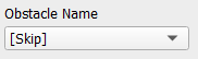
or non mandatory data Obstacle name:
In that case user have to enter "missing" values via keyboard by:
- selecting [Use value:] and enter value if there is no data related to Country name, Obstacle type in input file:
- selecting [Skip] if there is no data related to Obstacle name in input file
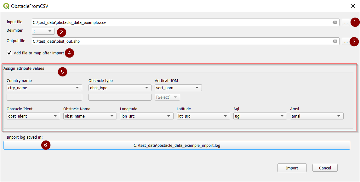
To import obstacles from CSV that contain all fields that are in outut file follow these steps:
- Click button next to Input file field to select input data file.
- Choose current field delimiter from Delimiter drop-down list.
- Click button next to Output file field to select output data file.
- If you want to add ouput data file to map automatically after import, check checkbox Add file to map after import
- Assign CSV fieds from input data file to fields in outpu file.
- To see import log click button below Import log saved in:
Note that CSV fields from data file will be automatically assigned to corresponding output field fields in case they have the same name. Otherwise you have to do it manually after getting familiar with input data file structure.
Exmaple import log:
2021-07-11 14:22:38.074168 | Line skipped. Input data error: Longitude error: 1211207.94S
2021-07-11 14:22:38.081181 | Line skipped. Input data error: Amsl must be a number: 291S.
2021-07-11 14:22:38.082165 | Line skipped. Input data error: Longitude error: 1211705.01N