Description
Plugin PlainTextToGeometry allows user swiftly extract coordinates from plain text and create points, lines or polygons.
It might be very useful in cases where there is a need to create spatial features based on textual description of geographic features as plain text, for example
from aeronautical publication such as eAIP (electronic Aeronautical Information Publication), NOTAM (Notice To AirMen) or any other data
with coordinates and this data is not
structurated well such as CSV or DAT files.
GitHub repository: PlainTextToGeometry
Usage
To extract coordinates from plain text and create feature just:
- Open PlainTextToGeometry plugin
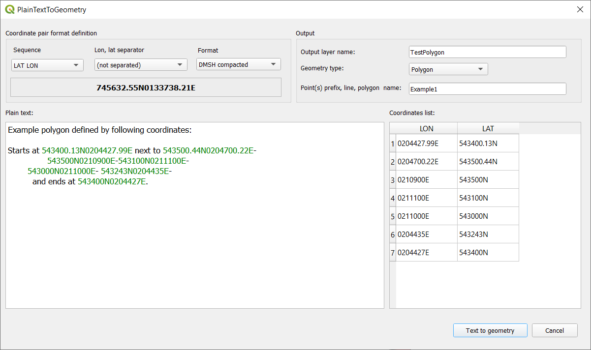
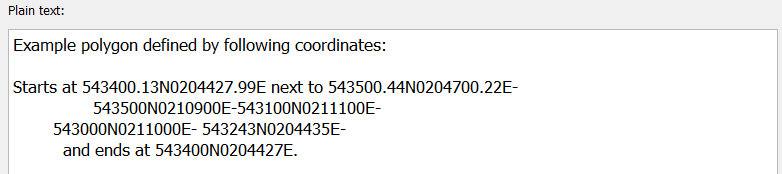
- Enter text with coordinates into Plain text area:
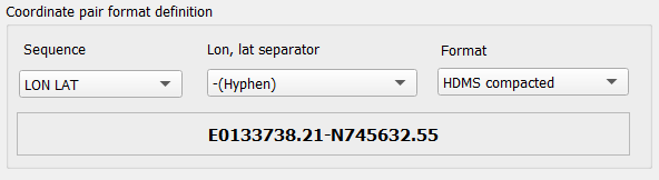
- Define coordinates pair format that you want to extract:
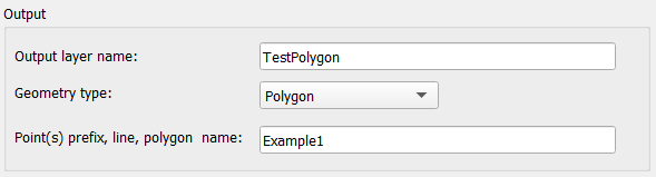
- Set output layer name, geometry type and name for the feature created from extracted coordinats.
In case output layer geometry type is Point - give name that will be used as prefix for point names.
Each point names will be in pattern: [prefix_by_user]_[number] where number is automatically generated from 1 to number of extracted point. - Press button
 to find coordinates and create feature(s).
 - If maching coordinates found in plain text:
- Coordinates will be marked as green in plain text field
- Coordinates list will be populated
- Feature(s) will be added to map
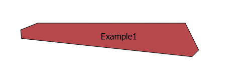
As a result following polygon has been created and added to map canvas:
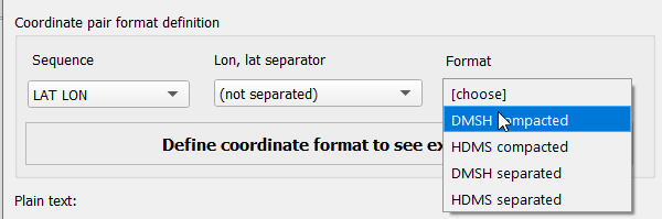
Notice that when you set Sequence, Lon, lat separator, Format example of coordinates pair will be shown: